Temperatures in August were colder than normal for six of the nine stations discussed in this summary. Barrow had the highest positive deviation, a substantial 6.3 degrees Fahrenheit above the mean, falling in line with the warming observed in northern Alaska in the past decades.
Big Delta (1 degree) and Fairbanks (0.2 degrees) rounded out the stations with positive deviations. The greatest negative deviation was in King Salmon (minus 1.6 degrees), followed by Kodiak (minus 1.5 degrees) and Juneau (minus 1.3 degrees). While the number of stations with below normal temperatures outnumbered the stations with above normal temperatures by two to one, the mean deviation was just above normal at 0.1 degree Fahrenheit; this is a result of the extremely warm August in Barrow.
Precipitation was also mixed in August, with just three stations reporting above normal totals, while the others six had precipitation deficits. Expressed as percentages, Nome reported the greatest positive deviation, with 66 percent above normal. Ketchikan was the driest station with just 58 percent of the normal amount of precipitation. The mean deviation of all nine stations was 7 percent below normal.
|
|
In Fairbanks the average temperature for August was 56.3 degrees Fahrenheit, just 0.2 degrees above the long-term mean. The lowest temperature for the month hovered above freezing at 37 degrees on the 22nd. The month’s highest temperature was an enjoyable 78 degrees on the 14th. Temperatures generally stayed in the expected trend and no new record events were recorded.
Like July, precipitation was below normal in August at 1.45 inches, 0.43 inches below the expected value of 1.88 inches. More than half of the monthly precipitation was observed on just one day – August 26. The mean wind speed was 3.4 mph, with a maximum gust of 33 mph on the 27th that blew from the west.
In Big Delta, the mean temperature for August was 56.1 degrees Fahrenheit, 1.3 degrees above the long-term normal of 54.8 degrees. The highest temperature, 78 degrees, was observed on the 14th. The month’s lowest temperature dropped below freezing. It was 31 degrees on the 29th. Temperatures were mixed in regard to the expected trend, mostly falling in line, with some dips at the beginning of the month and near the end. No new daily records were observed.
Precipitation was reported at 56 percent of the expected amount of 1.89 inches, with a total of 1.05 inches.
The average temperature in Juneau for August was 54.6 degrees Fahrenheit, 1.3 degrees below the long-term mean. The maximum temperature of the month was 72 degrees, occurring on the 14th. The month’s minimum temperature was a cool 38 degrees and occurred on the 30th. Temperatures started cool at the beginning of August with little daily variation due to the soggy weather. However, warmer temperatures occurred at the middle and end of the month.
|
|
Precipitation fell on 21 days of the month; hence the total precipitation was higher than normal at 7.59 inches. This amount is 1.86 inches above the expected amount of 5.73 inches. On August 8, 1.21 inches of rain fell, just breaking the previous record for that day (1.18 inches) set in 2002. Then on the 28th, a total of 1.28 inches of precipitation was measured, surpassing the 1988 record of 0.76 inches. The average wind speed was 5.3 mph. The maximum wind speed for the month was 30 mph on the 8th, which blew from a southeasterly direction.
Anchorage was slightly cooler than normal in August, with an average temperature of 55.9 degrees Fahrenheit, 0.8 degrees below the expected temperature. However, this temperature was above the July mean of 55.5 degrees. The month’s maximum temperature, 71 degrees, occurred on the 14th. The month’s minimum temperature, 40 degrees, occurred on the 29th. August temperatures generally followed the expected trend for the month.
Precipitation at 2.05 inches was less than expected and was 37 percent below normal. The average wind speed was 6.5 mph. The month’s strongest gust was recorded at 47 mph on the 26th, blowing from a southeasterly direction.
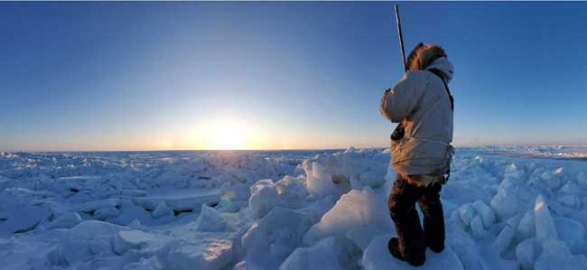
Barrow experienced the fifth month in a row with above normal temperatures. The mean value was 45.3 degrees Fahrenheit, a very substantial deviation of 6.3 degrees above the normal of 39 degrees. The August mean temperature was higher than the July 2012 value of 44 degrees Fahrenheit. The highest temperature, 66 degrees, occurred on the 19th, which was a new daily record. The previous record was 63 degrees set in 1923 and then tied in 1954. The daily temperature maximum was tied on the 22nd at 63 degrees. The previous record was set in 1972. The lowest temperature, 29 degrees, was reported on the 11th. This matched the low temperature from July. In another indication of the extreme warmth of August 2012, six new daily high minimum temperature records were set between the 14th and 22nd.
|
|
Precipitation in Barrow (1.09 inches) was slightly above the normal value of 1.05 inches, while the snowfall (trace amount) was less than the normal value of 0.9 inches. The average wind speed was 12.1 mph. The maximum gust occurred on the 5th, blowing from a southerly direction. It was recorded at 41 mph.
Ketchikan reported slightly colder than average temperatures, with a mean temperature of 57.5 degrees Fahrenheit, minus 0.5 degrees under the long-term mean of 58 degrees. The maximum temperature for the month was 75 degrees, which occurred on the 17th. The month’s minimum temperature, 45 degrees, was reported on the 30th.
Precipitation was significantly lower than normal, reporting 5.68 inches or just 58 percent of the long-term mean of 9.81 inches.
In King Salmon, the average temperature was 53 degrees Fahrenheit. This temperature was 1.6 degrees below the long-term mean and warmer than the July 2012 mean of 52.3 degrees. The maximum temperature, 73 degrees, for the month was reported on the 12th. The month’s minimum temperature occurred on the 28th and just hit freezing at 32 degrees Fahrenheit.
King Salmon had a lower than normal amount of precipitation with a total of 2.64 inches, 0.31 inches below the long-term mean. The average wind speed was 7.8 mph. The highest gust was 51 mph and occurred on the 18th, blowing from the south.
Kodiak was cooler than normal, experiencing a mean temperature of 53.7 degrees Fahrenheit. This mean temperature was 1.5 degrees less than the expected mean of 55.2 degrees. The maximum temperature for the month, 69 degrees, was observed on the 26th. The month’s minimum temperature was 40 degrees, reported on the 22nd. The low temperature of 41 degrees on the 18th set a new daily record minimum temperature for that day, breaking the 1985 record.
Precipitation was 30 percent below normal with a total of 3.18 inches, 1.38 inches under the normal amount of 4.56 inches. The average wind was 6.9 mph. The month’s highest wind gust occurred on the 27th at 44 mph, blowing from a westerly direction.
|
|
Nome had a mean temperature for August of 49.2 degrees Fahrenheit, 0.9 degrees below the normal value of 50.1 degrees. The maximum temperature was reported at 71 degrees on the 11th. The minimum temperature for the month was observed on the 20th and stayed above freezing at 35 degrees.
In July, Nome had nearly three times the normal amount of precipitation. August also had above normal rainfall with a total of 5.35 inches. This is 2.13 inches over the normal amount of 3.22 inches. Helping contribute to this high total was a record precipitation event on the 18th when 1.06 inches fell, breaking a record set back in 1973. The average monthly wind speed was 8.1 mph. The month’s maximum wind speed was 44 mph, occurring on the 24th. It blew from a southwesterly direction.
This information consists of preliminary climatological data compiled by the Alaska Climate Research Center, Geophysical Institute, University of Alaska Fairbanks. For more information on weather and climatology, contact the center at 474-7885 or visit the center web site at https://akclimate.org. Please report any errors to webmaster@akclimate.org.


