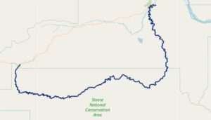
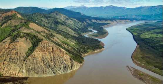
FAIRBANKS, Alaska — Monday, the Bureau of Land Management (BLM) Eastern Interior Field Office announced approval of a new comprehensive management plan for the Birch Creek Wild and Scenic River near Central. The approved plan, which updates a 1983 River Management Plan, outlines the BLM’s approach for managing 111 miles of the Ikhèenjik River, which was designated by Congress as a Wild and Scenic River (WSR) in the 1980 Alaska National Interest Lands Conservation Act (ANILCA). The plan considered multiple rounds of public scoping and review and was developed in cooperation with the State of Alaska, the U.S. Fish and Wildlife Service, and the National Park Service, and in consultation with Tribes and Alaska Native Claims Settlement Act Corporations in the region.
“This plan is a big step forward for Birch Creek and positions us to protect and enhance water quality, maintain biodiversity, and increase landscape resilience for this important river into the future with the latest science and monitoring,” said BLM Eastern Interior Field Manager Tim Hammond. “The plan accommodates interests of a variety of stakeholders by allowing for some enhanced recreation opportunities in both summer and winter while maintaining wild and scenic river values and emphasizing resource protection and ecological resilience.”
 The Birch Creek Wild and Scenic River was designated as a “wild” river pursuant to the Wild and Scenic Rivers Act by the Alaska National Interest Lands Conservation Act on December 2, 1980. By classifying Birch Creek as “wild,” Congress mandated that 111 miles of upper Birch Creek be managed to be free of impoundments, accessible by trail only, and maintained with undeveloped shorelines and clean water.
The new plan establishes management direction, user capacities, monitoring, and other management practices necessary to protect and enhance the ‘wild’ character and the river’s values (the river’s free-flowing condition, water quality, and outstandingly remarkable fisheries, scenic, and recreation values. The monitoring decisions in the plan represent a balance between enhanced, all-season recreation in the WSR corridor and retention of wild river designation characteristics in this semi-primitive recreation management zone.
Approximately 77 miles of Birch Creek Wild and Scenic River flow through the Steese National Conservation Area before flowing into the broad expanse of the Yukon Flats in central Alaska. Visitors enjoy float trips on the beautiful, remote river and appreciate the convenience of access at both ends of the ‘wild’ river segment from BLM recreation sites along the Steese Highway.
The decision record, environmental assessment, and other documents are available on the BLM NEPA register project website.
[content id=”79272″]


