Satellites and Shipwrecks: Landsat Satellite Spots Foundered Ships in Coastal Waters
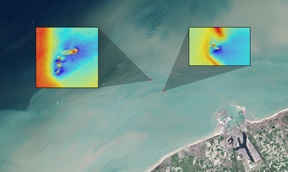
![In this natural color Landsat OLI image, long sediment plumes extend from the wreck sites of the SS Sansip and SS Samvurn. Insets show elevation models (created by a multibeam echosounder) of the wrecks on the seafloor. Credits: NASA/USGS Landsat/Jesse Allen/NASA Earth Observatory/Matthias Baeye et al Satellites and Shipwrecks: Landsat Satellite Spots Foundered Ships in Coastal Waters](https://alaska-native-news.com/wp-content/uploads/2016/03/image14-03-2016-09.59.22.jpg)
An estimated 3 million shipwrecks are scattered across the planet’s oceans. Most maritime mishaps take place close to shore where hazards to navigation — such as rocks, reefs, other submerged objects and vessel congestion — are abundant. While there is a romantic association of shipwrecks and buried treasure, it is desirable to know where they […]