Shapes of Western Alaska bays influence local flood danger
By Jeff Richardson-UAF on Comments Off on Shapes of Western Alaska bays influence local flood danger
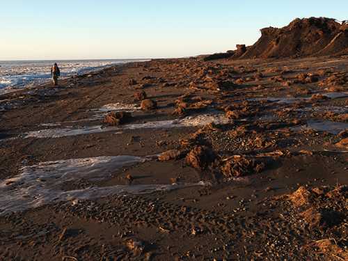
Photo by Alice Bailey A person walks along a storm-battered beach near Quinhagak after ex-Typhoon Merbok hit Western Alaska in 2022.
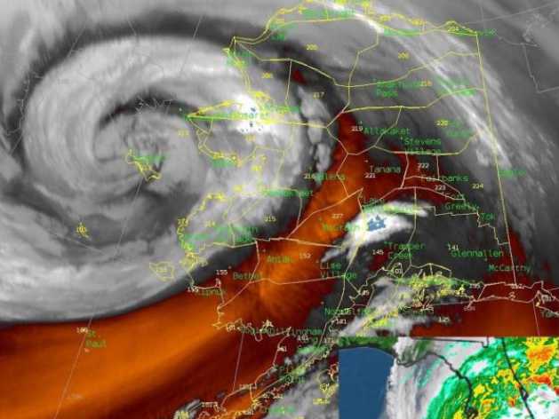
When large storms hit Western Alaska, some areas fare much worse than others. New research studying ex-Typhoon Merbok in September 2022 has found that a complex recipe of topography, tidal influences and seasonal water-level changes contribute to those differences.
“When we look at these differences, we need to find out what’s generating storm surges to begin with,” said Steven Dykstra, an assistant professor at UAF’s College of Fisheries and Ocean Sciences who led the study. “Why are storms and floods more intense in some places but not others?”
The effects of climate change, including general warming patterns and the loss of sea ice, have contributed to more powerful storms. But along with those factors, the geometry of Western Alaska’s massive bays and the region’s diverse tides amplified some storm surges during Merbok.
Norton Sound saw the largest surges, while Bristol Bay’s were the smallest. Conditions in Kuskokwim Bay generally landed somewhere in the middle.
To understand why, the research team needed to “detide” their storm surge data to remove the influences of other water-level fluctuations. They developed an analysis tool to better calculate how tides are influenced day-to-day by storms, ice and river conditions.
They also created a new statewide map using National Oceanic and Atmospheric Administration data to show how marine water levels change around Alaska throughout the year. Seasonal mean water-level can vary by as much as 16 inches.
“If your starting point is a foot higher and you add a storm surge, it’s going to make a difference,” Dykstra said.
After removing tides and seasonal factors, the influence of the shape of basins and water depth became clearer. Shallow water dampened storm surges. Long, landward funneling bays amplified them. For example, tides in the Kuskokwim River normally decrease as they go inland. During Merbok, the bay’s funnel shape caused the storm surge to become larger as it moved upriver toward Bethel.
That information could help forecasters better predict how wave behavior could influence flooding risks in various Western Alaska communities, said Heather Best, a National Weather Service hydrologist.
“This is of interest to us for anticipating impacts during coastal flooding events,” Best said. “Improvements to tide and wave models allow us to be more precise in our messaging to communities during storm events.”
A better understanding of flooding dynamics in the region is badly needed to help communities and planners prepare for hazards, Dykstra said. When global data is compiled to calculate extreme weather events, models have seldom included information from Western Alaska because it is often unavailable or incomplete.
“The data is either poor, or it doesn’t make sense to them,” Dykstra said. “It doesn’t fit their models and shows up as outliers.”