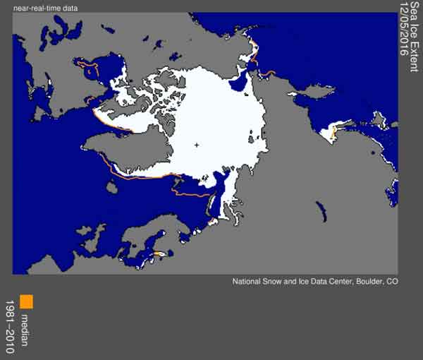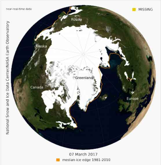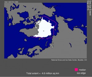
BOULDER, Colo., October 6, 2015—At the end of its melt season, the Arctic’s ice cover fell to the fourth lowest extent in the satellite record, both in the daily and monthly average, according to scientists at the National Snow and Ice Data Center (NSIDC). Sea ice extent hit 4.41 million square kilometers (1.70 million square miles) on September 11 and averaged 4.63 million square kilometers (1.79 million square miles) for the month of September.
This year edged out 2008 as the fourth lowest extent since satellites started regularly monitoring sea ice in 1979. The lowest Arctic extent on record occurred in 2012, when sea ice measured 3.62 million square kilometers (1.40 million square miles).
Through 2015, Arctic sea ice has now been declining at a rate of 13.4 percent per decade relative to the 1981 to 2010 average. The nine lowest September ice extents over the satellite record have all occurred in the last nine years.
“What we have seen this summer reinforces our conclusions that Arctic sea ice extent is in a long-term decline and that we are headed for a seasonally ice-free ocean,” said NSIDC director Mark Serreze.
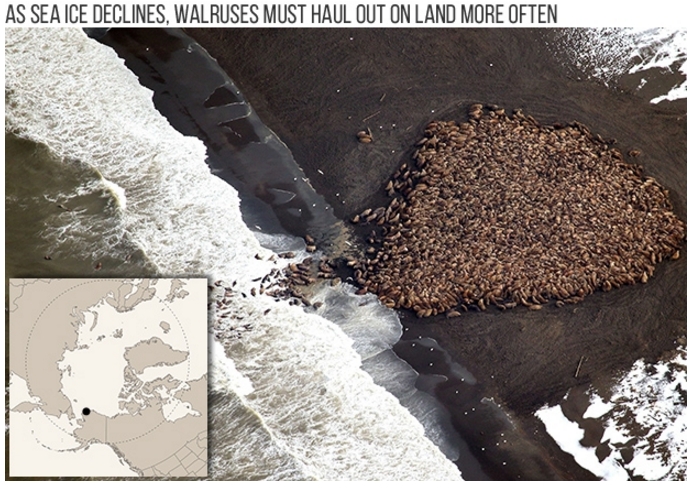
Arctic sea ice cover grows each autumn and winter as the sun sets for several months, and shrinks through spring and summer as the sun rises higher in the northern sky. Each year, the Arctic sea ice reaches its minimum extent in September. The downward trend in the extent of summer sea ice is important because it influences how much sunlight is reflected, which in turn affects climate. The loss of summer ice is affecting Arctic ecosystems and is making the region more accessible to shipping and other activities.
The summer melt season began earlier than average. The maximum winter extent, reached on February 25, 2015 at 14.54 million square kilometers (5.61 million square miles), was also the lowest recorded over the period of satellite observations. Between the seasonal maximum extent in February and the minimum in September, the Arctic Ocean lost a total of 10.13 million square kilometers (3.91 million square miles) of ice—the seventh largest total melt season ice loss in the satellite record. This year’s loss was 1.78 million square kilometers (687,000 square miles) less than the total loss that occurred in 2012, the record low year.
“Every year since 2007 has seen more than 10 million square kilometers of seasonal ice melt, reflecting both a transition towards thinner winter ice that melts out more easily in summer as well as changes in the Arctic climate that foster more ice melt each year,” said NSIDC senior scientist Julienne Stroeve.
In addition to an earlier and record-low maximum, early ice retreat and a fast July and August rate of ice loss contributed to this year’s low minimum extent. Strong winds from the eastern Beaufort Sea contributed to earlier than average melt onset and led to the early development of open water in the Beaufort Sea and along the coast of Canada. The pace of seasonal ice loss also picked up rapidly in July, with Arctic-wide temperatures reaching thesecond warmest during the satellite record (with 2007 ranked as the warmest). By the end of July, the fast pace of ice loss during the month resulted in the 2015 extent falling within 550,000 square kilometers (212,000 square miles) of the 2012 record low extent, and tracked below the levels recorded for 2013 and 2014. However, temperatures for August were not particularly warm, and extent ended up fourth lowest.
“Another characteristic of this summer was further loss of the thicker multiyear portion of the ice pack. In the past, most of this multiyear ice was too thick and compact to melt completely, but now it’s more vulnerable,” said Walt Meier, research scientist at the NASA Goddard Space Flight Center. Meier is an affiliate scientist at NSIDC and is part of the Arctic Sea Ice News and Analysis team.
“Ten years ago this would have been an astonishing summer of ice melt,” said Ted Scambos, NSIDC’s lead scientist. “Now it is just another season in a decade of low years.”
[content id=”18625″]


