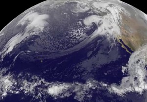
The ‘‘Pineapple Express’’ happens when warm air and lots of moisture are transported from the Central Pacific, near Hawaii, to the Eastern Pacific Ocean. An animation of satellite imagery from NOAA’s GOES-West satellite showed the stream of clouds associated with that moisture from Dec. 9 to Dec. 12, 2014 and brought rain and snow to the western U.S.
A wide-field movie by NOAA’s GOES-West satellite shows the Pineapple Express’ stream of clouds and moisture that created violent rain storms in California, record rainfall, landslides and flash flooding in the San Francisco area. The video was created by NASA/NOAA’s GOES Project at NASA’s Goddard Space Flight Center in Greenbelt, Maryland.
On Dec. 11, the storm system generated winds gusts that damaged homes in Lake Tahoe area, and rain and snow in Northern California. Whiteouts were reported the Sierra Nevada Mountains. Oregon and Washington State also experienced rain and snow.
Bill Patzert, climatologist for NASA’s Jet Propulsion Laboratory in Pasadena, California said, “After three years of punishing drought, Californians are shaken by this second December ‘Pineapple Express’ enhanced soaker. The storm did some damage, but it also moving through California quickly and will probably not be a record-breaker.”
Patzert compared this ‘Express’ to the storms of December 2010, when 10.23 inches of rain fell in Los Angeles from Dec. 6 to 29, causing massive flooding. “Those storms just kept coming. It was memorable,” he said. “This storm was like a 12-hour event. That was a 12-day event.”
The International Space Station-RapidScat instrument captured wind data near central California’s coast on Dec. 12 at 01:43 UTC (5:43 p.m. PST, Dec. 11). The RapidScat image showed sustained winds of 30 meters per second/67 mph just off-shore from the San Francisco area.
On Dec. 12 at 3:48 a.m. EST, NOAA’s National Weather Service Weather Prediction Center (NPC) in College Park, Maryland issued a short range forecast discussion about the Pineapple Express.
NPC noted: A strong Pacific storm will continue moving through the western states through the weekend. Impacts will include heavy precipitation, including mountain snows affecting travelers, strong, damaging winds, flash flooding, mud and debris flows, mainstem river flooding and damaging high surf. Thunderstorms and waterspouts are possible Friday in California and just off the coast.
From Los Angeles to San Diego and points south on Dec. 12, an Urban and Small Stream Flood Advisory is in effect. In addition a high surf advisory in effect for southwest California beaches through Saturday.
Patzert said the greatest upside of the recent storms were for the northern and central Sierras, where places like Southern California get much of their water. “They¹re definitely getting snow,” he said. “The snow season is getting off to a fast start and that’s a huge plus regarding drought relief.”
GOES satellites provide the kind of continuous monitoring necessary for intensive data analysis. Geostationary describes an orbit in which a satellite is always in the same position with respect to the rotating Earth. This allows GOES to hover continuously over one position on Earth’s surface, appearing stationary. As a result, GOES provide a constant vigil for the atmospheric “triggers” for severe weather conditions such as tornadoes, flash floods, hail storms and hurricanes.
For updated information about the storm system, visit NOAA’s National Weather Service website: www.weather.gov

