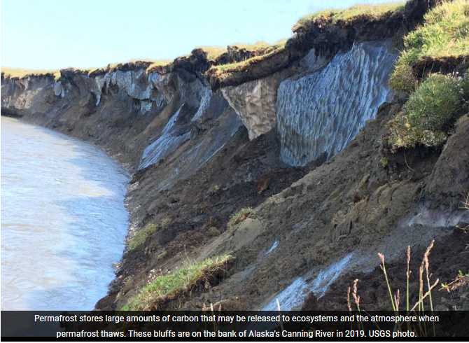
Permafrost in Alaska has been warming and thawing at an increasing rate. The state is actually sinking a little in places.
Soumitra Sakhalkar, a graduate research assistant at the University of Alaska Fairbanks Geophysical Institute, has been using the global navigation satellite system to precisely measure just how much the surface is subsiding in some places on Alaska’s North Slope.
“This enables us to understand seasonal permafrost settlement,” Sakhalkar said. “That helps us to understand the impacts that the rapidly changing climate has on the ecosystem.”
Fieldwork based out of the university’s Toolik Lake Field Station was done over two years to validate the satellite data.
Sakhalkar is presenting his research Thursday at the annual meeting of the American Geophysical Union in Chicago.
Thawing of ice-rich permafrost induces long-term subsidence, which can radically change the hydrological and ecological functioning of landscapes. A general trend in the study area from 2017 to 2022 shows an average annual subsidence ranging between 2 and 3 inches, with the largest occurring in the warm summer of 2019.
That thawing has consequences, such as releasing previously locked-up carbon and methane into the atmosphere and allowing water in lakes to soak into the thawed ground. Disappearance of lakes then affects migratory birds and other wildlife that rely on them.
It causes problems for Arctic infrastructure such as roads, which sink and crack as the ground heaves and thaws.
“And houses are slowly subsiding and becoming unstable,” Sakhalkar said.
[content id=”79272″]

