ANCHORAGE, Alaska – As part of an Alaska Native Claims Settlement Act land conveyance to Eklutna Inc., the Bureau of Land Management (BLM) has issued an updated navigability determination for the upper Knik River, finding that the river is navigable from Friday Creek to the Knik Glacier (the portion of the river commonly considered to constitute the upper Knik River).
Since statehood, BLM has been working with the State on navigability determinations. The State submitted new information to BLM regarding the navigability of the upper Knik River in August 2016 and in the spirit of cooperation, BLM agreed to further investigate its previous navigability determinations. BLM had determined the upper Knik River was not navigable based on a lack of evidence confirming historical use as a highway of commerce.
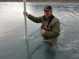
BLM staff conducted a field examination in early May and found the upper Knik River is at least three-feet deep along its entire length. Based on these physical characteristics, the BLM then determined the upper Knik River was susceptible to use for travel, trade, and commerce at the date of statehood, January 3, 1959, despite there being no record of the upper Knik actually being used for commerce at that time. In particular, BLM determined that the river was capable of being used by boats that were common at that time, including 18- to 24-foot propeller-driven boats, while carrying payloads of at least 1,000 pounds.
Because historical evidence, such as old photos, as well as present-day use with boats commonly in use at the time of statehood, are critical to navigability determinations, the BLM actively seeks evidence of navigability of water bodies on federal lands from the public. The Supplement to the Knik River Navigability Determination can be found on the web at the Alaska Land Transfer Program site. For information or to provide evidence on navigability, call Dave Mushovic, Branch Chief of Lands and Realty at (907) 271-2503 or by email at dmushovi@blm.gov.
Source: BLM [xyz-ihs snippet=”Adsense-responsive”]
