Image Credit: NASA/Carla Thomas
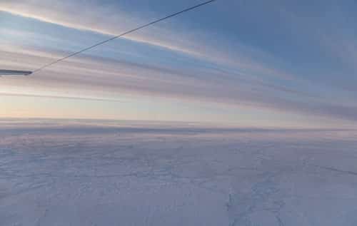
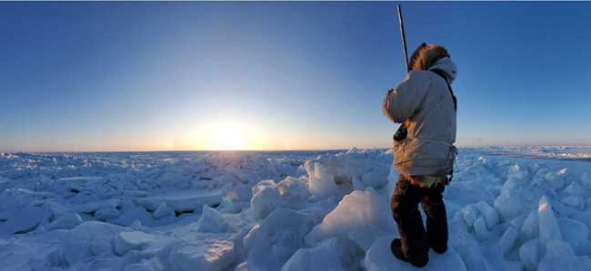
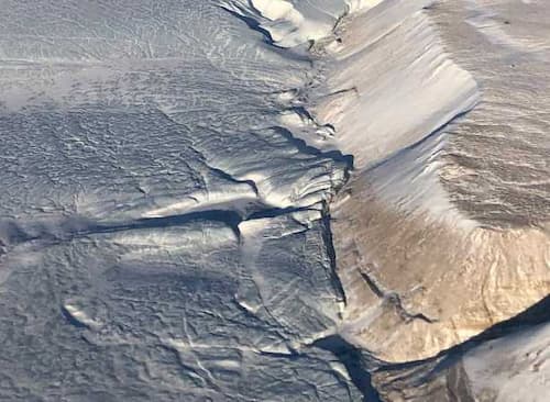
Sea ice in summer looks dramatically different than sea ice in winter, even in the polar Arctic. Summer snowmelt, pools of water on thinning ice and exposed ocean replace vast winter expanses of white snow-covered ice – and this weekend NASA’s high-flying laser altimeter begins a campaign to investigate these features.
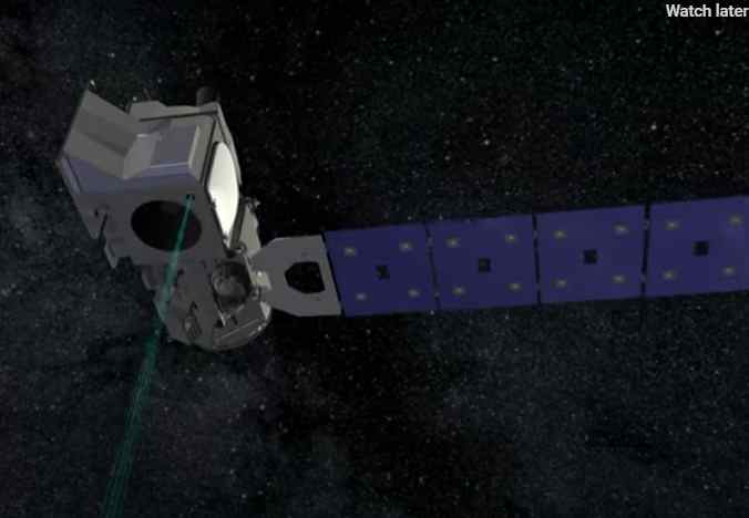
Icy areas look different from a satellite’s perspective as well. When NASA launches the Ice, Cloud and land Elevation Satellite-2, or ICESat-2, in 2017, it will measure Earth’s elevation by sending out pulses of green laser light and timing how long it takes individual photons to bounce off Earth’s surface and return. The number and patterns of photons that come back depend on the type of ice they bounce off – whether it’s smooth or rough, watery or snow-covered.
To get a preview of what summertime will look like to ICESat-2, NASA scientists, engineers and pilots have travelled to Fairbanks, Alaska, to fly an airborne test bed instrument called the Multiple Altimeter Beam Experimental Lidar, or MABEL. MABEL collects data in the same way that ICESat-2’s instrument will – with lasers and photon-detectors. So the data from the Alaskan campaign will allow researchers to develop computer programs, or algorithms, to analyze the information from ICESat-2.
“We need to give scientists data to enable them to develop algorithms that work during summer,” said Thorsten Markus, ICESat-2’s project scientist at NASA’s Goddard Space Flight Center in Greenbelt, Maryland. “All the algorithms need to be tested and in place by the time of launch. And one thing that was missing was ICESat-2-like data on the summer conditions.”
Between July 12 and August 1, MABEL will fly aboard NASA’s high-altitude ER-2 aircraft as the Arctic sea ice and glaciers are melting. In its half-dozen flights, the instrument will take measurements of the sea ice and Alaska’s southern glaciers, as well as forests, lakes, open ocean, the atmosphere and more, sending data back to researchers on the ground.
A key element of the campaign, however, is to fly over melt ponds – areas where snow has melted, pooling up in low spots of the sea ice or glaciers – and bare ice with no snow coverage to find out how to identify and study these features with ICESat-2-like data.
Scientists have many questions about melt ponds, and their impact on the extent of summer ice melt. Dark water absorbs much more heat from the sun than bright, reflective ice and snow, so when a pool of liquid water forms on top of ice, it changes the heat balance. The water warms up in the summer sun, and can speed up melting of the surrounding ice, possibly influencing the Arctic Ocean’s sea ice minimum extent.
“The melt pond coverage may be an indicator of the ice coverage at the end of the summer,” said Ron Kwok, a senior research scientist at NASA’s Jet Propulsion Laboratory in Pasadena, California. “But we don’t have a lot of information about melt pond coverage over the Arctic.”
Although scientists know the ponds are present, and cover a lot of area, they don’t know how the number, size and depth vary from year to year, and region to region, said Kwok, also a member of the ICESat-2 Science Definition Team who is developing sea ice algorithms.
Melt ponds can also tell researchers about the sea ice itself, Kwok said. Deeper, smaller ponds can form on the bumpy and ridged older ice, which has withstood multiple years in the Arctic Ocean. Newer ice – ice that formed the winter before – hasn’t had the time to build up ridges, and so would be flat and covered with large shallow ponds.
“In the summer, we can tell whether it’s first year ice or older, based roughly on the shape and size of the melt ponds,” Kwok said.
The MABEL flights will allow researchers to determine what those ponds and melting snow will look like from ICESat-2, and how to best analyze the returning photons. The ponds could be tricky to study, he said, since some photons might reflect off the surface, while others could make it through the water to bounce off the bottom of the pond.
“We have to design the algorithms to adapt to what we’re learning this summer,” Kwok said. “We don’t have any preconceived notions as to what we might see, and that’s why it’s so important to fly MABEL.”
The flight plans for the ER-2 carrying MABEL involve a route that would take it north, possibly over the North Pole, to look at a variety of sea ice conditions, as well as some ice fields north of Fairbanks, said Bill Cook, MABEL’s lead scientist. The aircraft will also fly above forests, along some of the same paths of another NASA campaign that is flying Goddard’s LiDAR, Hyperspectral and Thermal Imager, or G-LiHT, just above the treetops. Researchers will be able to then compare the data from MABEL and G-LiHT, Cook noted.
With 48 hours of flying time available, he said, the first priority are the flights north toward the pole to see how different the summer ice looks to MABEL.
Follow NASA campaigns blogging from Alaska this summer at:
https://earthobservatory.nasa.gov/blogs/fromthefield/
For more information on ICESat-2, visit:
https://icesat.gsfc.nasa.gov/icesat2/
For more information on G-LiHT, visit:

